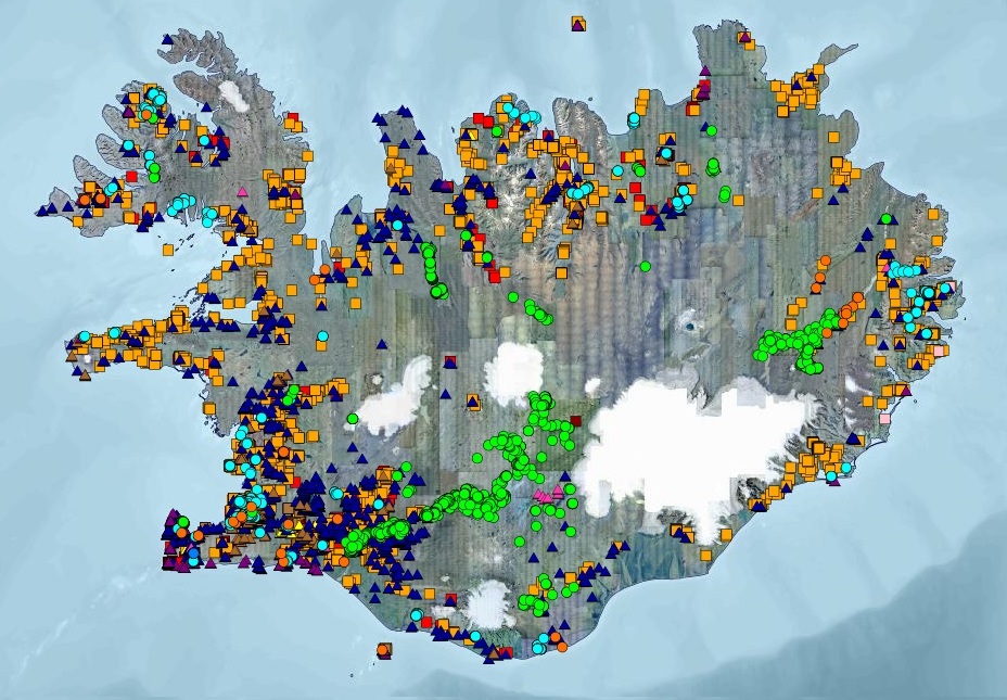
Borholur UOS
Gagnasett sem sýnir yfirlitsupplýsingar úr Borholugrunni Umhverfis- og orkustofnunar um borholur á Íslandi. Fram koma meðal annars: auðkennisnúmer borholu, borholunafn, staðarheiti, bortími, dýpi, sveitarfélag, eldra hreppsnafn, landnúmer, tilgangur og tegund borunar, bor og borfyrirtæki, staðsetningarhnit í ISN93 og WGS84, gæði hnita, fóðringardýpi og holuvídd. Í töflunni eru yfir 15.000 færslur. Upplýsingar úr gagnatöflunni eru bæði aðgengilegar á vefsíðu UOS og í Kortasjá UOS.
Simple
- Date ( Publication )
- 2017-04-27
- Identifier
- {5AF8AC2F-F11D-4FD8-B446-9EF1CB986B06}
- GEMET - INSPIRE themes, version 1.0 ( Theme )
- Keywords ( Theme )
-
- INSPIRE
- Borholur
- Jarðboranir
- Jarðhiti
- Nytjavatn
- GSL
- GSL flokkun ( Theme )
- Use constraints
- Other restrictions
- Other constraints
- Afhent frá UOS án gjalds - Geta þarf heimilda
- Access constraints
- Other restrictions
- Other constraints
- no limitations to public access
- Spatial representation type
- Vector
- Denominator
- 10000
- Metadata language
- is
- Topic category
-
- Geoscientific information
N
S
E
W
))
- Reference system identifier
- 3057
- Distribution format
-
-
ESRI Shapefile
(
1.0
)
-
csv
(
óþekkt
)
-
kmz
(
óþekkt
)
-
ESRI Shapefile
(
1.0
)
- OnLine resource
- http://opingogn.is/organization/orkustofnun
- OnLine resource
-
gisborhola
(
OGC:WMS
)
Borholur UOS
- OnLine resource
-
orkustofnun:gisborhola
(
OGC:WFS
)
Borholur UOS
- Hierarchy level
- Dataset
Conformance result
- Date ( Publication )
- 2010-12-08
- Explanation
- Information required according to INSPIRE Geoportal Validator´s verification report. Validation has not been performed.
- Pass
- Yes
- Statement
- Upplýsingar teknar úr Borholugrunni Orkustofnunar, en upplýsingar um borholur hafa verið í gagnagrunni frá árinu 1981.
gmd:MD_Metadata
- File identifier
- {B4EFCAC5-BB9B-42E2-998A-7808758E9D83} XML
- Metadata language
- en
- Hierarchy level
- Dataset
- Date stamp
- 2025-10-27T15:50:30
- Metadata standard name
- INSPIRE Metadata Implementing Rules
- Metadata standard version
- Technical Guidelines based on EN ISO 19115 and EN ISO 19119 (Version 1.2)
Overviews

Borholur 2017
Spatial extent
N
S
E
W
))
Provided by

Associated resources
Not available
 Lýsigagnagátt